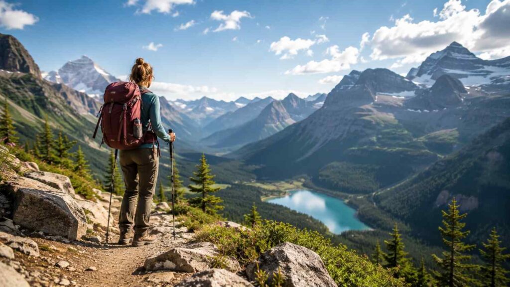
The Best Hiking Trails for Adventure Seekers
The Best Hiking Trails for Adventure Seekers are not always the longest, highest, or most technical routes in the world. A memorable trail creates an appropriate combination of physical effort, environmental uncertainty, dramatic terrain, and meaningful preparation. It should demand concentration and resilience while remaining possible for a properly trained and equipped hiker.
Adventure also means different things to different people. One traveler may want a steep day hike with narrow ledges and chains. Another may prefer a four-day route across volcanic deserts and glacial rivers. A third may be drawn to a high-altitude journey where gradual acclimatization and repeated trekking days matter more than technical climbing.
The six routes in this guide represent those different forms of challenge. Angels Landing and Half Dome offer iconic American summit experiences. Tongariro presents exposed volcanic terrain in New Zealand. Laugavegur crosses Iceland’s remote highlands, while the W Trek passes through the forests, valleys, lakes, and granite landscapes of Patagonia. Everest Base Camp combines Himalayan scenery with altitude, culture, and a demanding itinerary.
These trails are not ranked because “best” depends on individual goals and ability. Instead, each destination is assessed according to the kind of adventure it provides, the preparation it demands, and the official rules that affect planning.
Conditions can change after an article is published. Always verify permits, access, transport, weather, closures, guide requirements, and trail notices with the responsible park or tourism authority shortly before departure.
Related Articles
Best Challenging Day Hikes for Adventure Seekers
A challenging day hike compresses a significant amount of effort and decision-making into a single outing. Hikers may not need camping equipment or multiple accommodation bookings, but they still have to manage elevation, exposure, changing weather, water, daylight, and the return journey. The absence of an overnight stay should never be mistaken for an absence of risk.
Day routes are particularly demanding when the hardest terrain appears near the destination. A hiker may already be tired before reaching the Angels Landing chains, Half Dome cables, or Tongariro’s steep volcanic descent. This pattern makes pacing important. Reaching the famous section with limited energy can affect balance, judgment, and confidence.
Successful preparation starts well before the trailhead. Build endurance through progressively longer hikes, practise sustained climbing and descending, and test the footwear, layers, food, and hydration system you intend to use. An early start creates more daylight and may reduce exposure to afternoon storms, crowds, or transport deadlines.
A turnaround time should be decided before the hike begins. A summit, crater, or viewpoint is optional when weather deteriorates, daylight becomes limited, or a group member is struggling. Permits provide access, not a guarantee that conditions will be suitable.
The following trails offer three distinct day-hiking challenges: narrow exposure in Zion, a long granite ascent in Yosemite, and a point-to-point volcanic crossing in New Zealand.
| Hiking Trail | Adventure Type | Difficulty Level | Estimated Duration | Best For |
|---|---|---|---|---|
| Angels Landing | Exposed Ridge Day Hike | Very Hard | Half Day | Experienced hikers comfortable with heights |
| Half Dome | Granite Summit Climb | Very Hard | Full Day | Endurance-focused hikers |
| Tongariro Alpine Crossing | Volcanic Alpine Hike | Hard | 7–8 Hours | Alpine and volcanic landscape lovers |
| Laugavegur Trail | Wilderness Multi-Day Trek | Hard | 3–5 Days | Backpackers seeking remote scenery |
| W Trek | Glacier & Mountain Trek | Hard | 4–5 Days | Multi-day trekking enthusiasts |
| Everest Base Camp | High-Altitude Trek | Very Hard | 12–14 Days | Hikers seeking Himalayan adventure |
Angels Landing, Zion National Park, United States
Angels Landing is a 5.4-mile round trip with 1,488 feet of elevation gain, and the National Park Service says many hikers need about four hours, although individual times vary. The approach climbs from Zion Canyon to Scout Lookout before the final half-mile section follows a narrow ridge supported by chains. A permit is required beyond Scout Lookout, while hikers can reach Scout Lookout without entering the permit lottery.
The route’s defining challenge is exposure rather than extreme distance. Steep drop-offs, narrow passages, other hikers, and the need to share the chain can make the final section mentally demanding. People with a strong fear of heights should treat Scout Lookout as a valid destination rather than feeling pressured to continue.
Weather can quickly make the route inappropriate. NPS advises against ascending when storms are nearby, the ground is wet or icy, darkness is approaching, or the hiker is uncomfortable with heights. Wet sandstone becomes slippery, and afternoon thunderstorms can create additional danger on exposed terrain.
Prepare by downloading the permit, carrying water and a headlamp, wearing broken-in footwear with traction, and checking shuttle and park conditions. The adventure lies in making calm decisions on serious terrain, not in continuing when the ridge is unsafe.
Half Dome, Yosemite National Park, United States
Half Dome is a much longer day than Angels Landing. Depending on the approach, the round trip is approximately 14 to 16.4 miles with about 4,800 feet of elevation gain. The route passes Vernal Fall and Nevada Fall, continues through or near Little Yosemite Valley, climbs the Subdome, and finishes with an ascent of steep granite using the famous steel cables.
Endurance is the central challenge before the cables even begin. Hikers must preserve enough energy for the summit section and the long descent to Yosemite Valley. An early start, reliable pacing, food, sufficient water, a headlamp, and a firm turnaround time are essential parts of planning.
Permits are required seven days per week whenever the cables are installed. Day-hiker access is managed through a preseason lottery and a limited daily lottery. The normal cable season runs from around late May into October, but installation and removal dates remain dependent on weather and trail conditions.
The granite becomes especially dangerous when wet, and hikers should not be on exposed domes during thunderstorms. Gloves may improve comfort on the cables, but equipment cannot make unsafe weather acceptable. Half Dome rewards hikers who combine strength with restraint, preparation, and enough energy to descend safely.
Tongariro Alpine Crossing, New Zealand
The Tongariro Alpine Crossing is a 20.2-kilometre point-to-point route through an exposed volcanic alpine landscape. The Department of Conservation lists a typical time of seven to eight hours from November through April and around nine hours in winter conditions. The trail rises to Red Crater at 1,886 metres before descending over loose volcanic scree past the Emerald Lakes and continuing toward Ketetahi.
Its difficulty comes from sustained distance, steep and uneven terrain, rapid weather changes, loose rock, and volcanic hazards. Strong wind, cold temperatures, heavy rain, poor visibility, and even snow can occur during summer. DOC also warns visitors to remain on the marked route and avoid geothermal vents and the culturally significant lakes.
The route requires transport planning because it is not a simple out-and-back hike. Parking restrictions apply at the road ends, and shuttle use is recommended. Bookings are encouraged for walkers and are required when using a shuttle or guided service.
From May through October, the experience changes into an expert alpine undertaking. Snow, ice, avalanche terrain, sub-zero conditions, and obscured markers require navigation skills, crampons, an ice axe, a helmet, avalanche equipment, and the ability to use them. Those without those skills should choose a guided winter trip or return in the regular hiking season.
Best Multi-Day Trekking Routes for Serious Adventure
Multi-day trekking introduces challenges that do not appear during a single outing. Hikers must recover sufficiently to walk again the following morning, manage changing clothing and weather, protect their feet, monitor food and hydration, and follow transport or accommodation schedules. A minor issue on day one can become a significant problem by day three.
Logistics are part of the adventure. Huts, campsites, teahouses, park tickets, guides, internal transport, and access roads may need to be reserved long before the trek. Remote trails often offer limited phone service, fewer opportunities to replace damaged equipment, and little flexibility when a scheduled vehicle or boat is missed.
Pack weight also changes the experience. Carrying camping equipment requires different conditioning from walking between huts or teahouses. Even supported treks still demand a suitable daypack, rain protection, warm layers, emergency items, and personal supplies. Every optional item becomes noticeable over repeated kilometres.
Multi-day routes should include contingency time. Weather may delay a bus in Iceland, close a trail in Patagonia, or disrupt flights to Lukla. An itinerary with no flexibility can pressure hikers into unsafe decisions.
The best multi-day treks for adventure seekers offer more than continuous difficulty. They lead through changing ecosystems, geological features, and communities, allowing the landscape to unfold over several days. Laugavegur, the W Trek, and Everest Base Camp demonstrate three very different versions of that experience.
If you’re still comparing destinations, exploring additional multi-day trekking inspiration can help you choose a route that matches your experience, preferred landscapes, and travel style.
Laugavegur Trail, Iceland
Laugavegur links Landmannalaugar with Þórsmörk across approximately 56 kilometres of Icelandic highland terrain. A common four-day itinerary divides the journey between Hrafntinnusker, Álftavatn or Hvanngil, Emstrur, and Þórsmörk. Faster itineraries are possible, but they increase the daily distance and reduce the margin for weather, photography, side trips, and recovery.
The route passes rhyolite mountains, geothermal areas, snow patches, black-sand plains, lava landscapes, glacial views, canyons, and birch woodland. That visual variety is one reason it is frequently included among the world’s best trekking routes.
The principal hazards are weather, visibility, cold, wind, and river crossings. Fog can obscure markers, snow may remain early in the season, and several rivers must be crossed on foot. Water levels can rise after rain, making a previously manageable crossing more difficult.
Hikers can use mountain huts or designated campsites, but advance booking is strongly recommended because hut capacity is limited and popular dates fill quickly. Access depends on highland roads and snow conditions; the Iceland Touring Association says the trail is generally assumed to be open from around late June to mid-September, although yearly conditions determine the real dates.
Prepare with waterproof layers, dry clothing, river shoes, navigation, emergency supplies, and an itinerary flexible enough to respond to Iceland’s rapidly changing weather.
W Trek, Torres del Paine National Park, Chile
The W Trek explores the central highlights of Torres del Paine National Park through a route shaped like the letter W. Depending on the itinerary, hikers visit areas associated with Base Torres, the Francés Valley, Lake Pehoé, and Grey Glacier. The journey combines granite peaks, open valleys, forests, glacial lakes, exposed slopes, and famously changeable Patagonian weather.
The trek is physically demanding without normally requiring technical climbing. The greater challenge is organising accommodation, park entry, transport, boat connections, trail opening times, and daily distances. Camping and overnight stays must use authorised locations, so hikers cannot simply stop wherever they become tired.
CONAF directs visitors to obtain current park information through its official website and Pases Parques. Rules can change with season, weather, concession operations, fire risk, and available services. In 2026, for example, CONAF announced a temporary June and July closure of the mountain W circuit, while Base Torres remained available only under specific guided conditions. That example shows why old itineraries cannot be treated as permanent instructions.
Prepare for strong wind, rain, sudden temperature changes, and long exposed sections. Carry waterproof layers even when the morning appears clear. Reserve accommodation and transport before arrival, respect trail-closing times, and leave enough itinerary flexibility for disrupted services. The W Trek rewards organisation as much as physical fitness.
Everest Base Camp Trek, Nepal
The Everest Base Camp trek is generally planned as a journey of about two weeks beginning and ending at Lukla. The classic route follows the Dudh Koshi valley toward Namche Bazaar, continues through Tengboche and the higher settlements around Dingboche or Pheriche, and then reaches Lobuche and Gorak Shep before the walk to base camp.
The defining difficulty is altitude rather than technical climbing. The route rises progressively into thin air, where walking speed, sleep, appetite, recovery, and decision-making can change. Nepal Tourism Board guidance stresses that acclimatization cannot be rushed and identifies rest or acclimatization periods around Namche and later in the itinerary.
Physical fitness does not prevent altitude illness. A strong athlete can become unwell if ascending too quickly. Hikers must understand symptoms, communicate honestly with guides, and be prepared to stop ascending or descend when necessary.
Current trekking documentation also needs verification. Nepal Tourism Board lists the Everest Base Camp trek among routes covered by revised provisions requiring a licensed trekking guide and a trekking-agency-issued TIMS card. Travellers should confirm the latest procedure through the official authority and a government-registered agency before booking.
The trail also depends on weather-sensitive transport to Lukla, teahouse logistics, cold-weather equipment, and sufficient contingency days. Its adventure comes from sustained effort, altitude, Himalayan culture, and the discipline to ascend gradually.
How to Choose, Prepare for, and Hike These Trails Safely
Choosing between exposed day hikes and remote multi-day routes requires more than comparing attractive photographs. Each trail has a different risk profile. Angels Landing demands comfort around narrow ridges, Half Dome requires endurance and cable confidence, Tongariro adds volcanic and alpine conditions, Laugavegur includes weather and river crossings, the W Trek requires complex reservations, and Everest Base Camp introduces high altitude.
Begin by separating physical difficulty from technical and environmental difficulty. Cardiovascular fitness helps with climbing, but it does not teach navigation, river-crossing judgment, crampon use, or altitude management. Training should resemble the actual route rather than consisting only of general exercise.
Create a written plan that covers access, start time, daily distance, water, food, permits, emergency contacts, turnaround points, and alternatives. Share the itinerary with someone who is not joining the trip. In remote areas, do not assume that a mobile phone will provide reliable communication.
Official safety guidance recommends choosing a trail that matches the entire group, checking weather and park alerts, carrying the Ten Essentials, leaving a trip plan, and preparing a Plan B. Cell service can be absent, so hikers may need an appropriate satellite communication or emergency device.
Use the following comparison as a starting point, not as a substitute for current official information.
| Trail | Format | Main Challenge | Planning Priority |
|---|---|---|---|
| Angels Landing | Day hike | Narrow exposed ridge and chains | Permit, weather, height tolerance |
| Half Dome | Long day hike | Major elevation gain and cable ascent | Permit lottery, early start, endurance |
| Tongariro Alpine Crossing | Point-to-point day hike | Volcanic alpine terrain | Shuttle, weather, seasonal skills |
| Laugavegur | Multi-day trek | Remote weather and river crossings | Hut or campsite booking, transport |
| W Trek | Multi-day trek | Patagonian weather and logistics | Park entry, accommodation, current rules |
| Everest Base Camp | High-altitude trek | Acclimatization and sustained walking | Guide, documents, gradual itinerary |
Assess Fitness, Exposure, and Altitude Experience
Train for the demands of the selected route rather than aiming only for a general fitness level. Long day hikes require sustained climbing and descending, while multi-day treks require the ability to repeat that effort with a backpack. Include progressively longer hikes, elevation, uneven surfaces, and consecutive walking days.
Exposure deserves separate consideration. Someone can be physically strong yet become uncomfortable on a narrow ridge or steep cable route. Practise on less serious exposed terrain with secure footing before choosing Angels Landing or Half Dome. Never discover your response to heights for the first time at the most difficult point of an iconic trail.
Altitude is another independent factor. Previous sea-level endurance does not predict how the body will respond in the Himalaya. High-altitude itineraries need gradual ascent, acclimatization days, symptom monitoring, and readiness to descend.
Evaluate the weakest relevant skill, not only the strongest. A group may have excellent endurance but limited navigation ability, or strong backpacking experience but no winter-alpine training. Choose a guide, easier season, or different trail when those gaps affect safety.
Turning around is not evidence that the training failed. It shows that the hiker is applying judgment to real conditions rather than following a plan blindly.
Confirm Permits, Seasons, and Trail Logistics
Permit research should happen before purchasing non-refundable flights, hotels, or tours. Angels Landing uses seasonal and day-before lotteries, while Half Dome has preseason and limited daily lotteries during the cable season. Obtaining either permit does not guarantee safe weather or suitable trail conditions.
Point-to-point routes require transport planning. Tongariro has road-end parking restrictions and recommends shuttle use, while Laugavegur access depends on the seasonal opening of Icelandic highland roads. The W Trek may involve park tickets, authorised accommodation, boats, buses, and trail-hour restrictions.
Confirm whether a guide is optional, recommended, or mandatory. Requirements can depend on the destination, route, and season. Tongariro winter travel needs specialist alpine competence, and current Nepal Tourism Board information lists the Everest Base Camp route under guide and TIMS provisions.
Download permits, maps, confirmations, and emergency details for offline use. Save copies in more than one place and carry identification where required. Recheck the official authority shortly before travel and again before starting.
Build contingency time into international itineraries. Weather-sensitive flights, roads, boats, and shuttles can disrupt even a carefully organised trip.
Carry Essential Gear and Protect the Environment
The Ten Essentials provide a practical foundation for both day hikes and multi-day routes. They cover navigation, hydration and water treatment, nutrition, insulation, illumination, first aid, sun protection, repair tools, emergency shelter, and fire-starting capability where permitted and appropriate. Additional gear depends on the route, weather, remoteness, season, and local regulations.
A headlamp belongs in every pack, including for a planned daytime hike. Delays caused by crowds, injury, slow progress, navigation problems, or transport issues can extend the day beyond sunset. Clothing should use adaptable layers rather than relying on one heavy item.
Trail-specific equipment may include trekking poles, river shoes, traction devices, crampons, an ice axe, a helmet, water treatment, or a satellite communicator. Carrying specialist gear is not enough; hikers must know how to use it before entering serious terrain.
Environmental responsibility is part of preparation. Stay on marked paths, camp only where authorised, pack out rubbish and food waste, avoid damaging vegetation, and follow local rules for water, fires, toilets, wildlife, and culturally significant places. Tongariro’s lakes and mountains hold deep cultural importance, while Iceland’s moss and highland soils are easily damaged.
Learning more about responsible hiking practices before visiting natural areas can also help you minimize your environmental impact while respecting local ecosystems and trail regulations.
Adventure should leave the landscape intact for the people and communities who follow.
Quick Answer About The Best Hiking Trails for Adventure Seekers
The strongest adventure trails combine memorable scenery with a clear physical, technical, environmental, or logistical challenge. Angels Landing and Half Dome offer steep climbing and exposed summit sections in the United States. New Zealand’s Tongariro Alpine Crossing leads hikers through an active volcanic landscape, while Iceland’s Laugavegur Trail adds changing weather, river crossings, huts, and remote highland terrain. Chile’s W Trek delivers a multi-day Patagonian experience, and Nepal’s Everest Base Camp route introduces sustained trekking at high altitude.
The right choice depends on more than distance. Hikers should compare elevation gain, exposure, trail surface, altitude, weather, permit systems, transport, accommodation, and emergency access. A short route with chains or narrow ridges may be more intimidating than a longer trail without exposure. Similarly, a physically fit hiker may still struggle with altitude, winter terrain, navigation, or repeated trekking days.
Before making reservations, read the current official trail information. Permit procedures, seasonal closures, shuttle operations, guide requirements, campsite rules, and weather advisories can change. Adventure begins with a meaningful challenge, but responsible preparation is what makes that challenge manageable.
What Makes a Hiking Trail Adventurous?
An adventurous trail creates a level of challenge beyond an ordinary recreational walk. That difficulty may come from steep elevation gain, exposed ridges, loose scree, steel cables, river crossings, snow, remote camps, unpredictable weather, or high altitude. The experience becomes more demanding when several of these factors occur on the same route.
Distance alone is an unreliable measure. A 5-mile trail with steep drop-offs and wet rock may require greater confidence and concentration than a 12-mile forest path. Multi-day routes add another layer because hikers must repeat the effort while managing food, shelter, weather, recovery, and equipment.
Remoteness also matters. A well-traveled park trail may have rangers, signs, and nearby assistance, while an isolated route can require independent navigation and emergency communication. Adventure seekers should therefore evaluate the specific hazards rather than relying only on a website’s “hard” or “expert” label.
A rewarding trail should stretch existing skills without depending on reckless choices. The best experience comes from understanding the challenge, preparing for it, and knowing when conditions require a different plan.
How Should You Choose the Right Trail?
Begin with an honest review of your recent experience. Consider the longest hike you have completed comfortably, the elevation gain you regularly manage, the weight you can carry, and whether you have walked on loose, wet, icy, or exposed terrain. Previous gym fitness helps, but it does not automatically provide trail judgment, navigation skills, or confidence around heights.
Next, compare the trail with your available time and support needs. Some hikers prefer a demanding day route with no overnight equipment, while others value the slower rhythm of a hut-to-hut or teahouse trek. High-altitude routes need gradual itineraries, and winter routes may require specialist equipment and formal alpine skills.
One thing I always check first is the official authority responsible for the route. Confirm permits, trail access, transport, accommodation, closures, water availability, and emergency guidance before paying for non-refundable arrangements. Current park information should take priority over an old itinerary or social-media post.
Choose a route that is challenging for the right reasons. The objective is to finish with a deeper appreciation of the landscape and your abilities, not to survive conditions for which you were unprepared.
Frequently Asked Questions
Hikers comparing famous routes often focus first on scenery, but the most useful questions concern suitability, permits, seasons, training, guides, and equipment. An iconic trail is not automatically appropriate simply because it appears on a bucket list. Every route must be considered in relation to the individual hiker’s experience and the conditions expected during the trip.
Difficulty descriptions also need context. “Challenging” may refer to distance, elevation, exposure, altitude, navigation, weather, or a combination of several factors. Two routes carrying the same rating can therefore demand very different skills.
Permit and guide requirements are equally important. Some systems are designed to manage crowding on narrow trail sections, while others support conservation, visitor safety, or trekking administration. These rules may change, and unofficial summaries can become outdated.
The answers below are intended as planning guidance rather than guarantees of access or safety. Before departure, check the park, conservation authority, trekking authority, weather service, transport provider, and accommodation operator relevant to the route.
When uncertainty remains, select a shorter trail, travel in a more suitable season, or use a qualified guide. The strongest adventure plan is not the one that eliminates flexibility. It is the one that allows the hiker to respond responsibly when real mountain conditions differ from expectations.
What Is the Best Trail for a First Adventure Hike?
The best first adventure trail is one that introduces a meaningful challenge without combining too many unfamiliar hazards at once. A fit hiker with experience on long, steep day walks may consider Tongariro during suitable non-winter conditions, provided the weather, shuttle, clothing, water, and decision points are understood.
Laugavegur may suit someone moving from day hiking into hut-to-hut trekking, but previous experience with variable weather, backpacking equipment, navigation, and river crossings is valuable. It should not be treated as an effortless beginner route.
Angels Landing is short compared with many mountain hikes, yet the exposed chain section can make it unsuitable for people who have not tested their response to heights. Scout Lookout provides a strong alternative without entering the permitted ridge section.
A first adventure route should build confidence rather than depend on luck. Choose good seasonal conditions, prepare an alternative, travel with experienced companions or a guide where appropriate, and avoid introducing altitude, winter terrain, major exposure, and remote camping all at once.
Which Famous Hiking Trails Require Permits?
Angels Landing requires a permit for the route beyond Scout Lookout. Zion distributes access through seasonal and day-before lotteries. Scout Lookout and many other Zion activities do not require the Angels Landing permit.
Half Dome requires a permit whenever the cables are installed. Day-hiker permits are distributed through a preseason lottery and limited daily lotteries, while qualifying backpackers request Half Dome access through the wilderness-permit process.
Other trails may use different forms of control. Torres del Paine requires current park-entry and authorised accommodation planning, while the Everest Base Camp route involves trekking documentation and current guide provisions. Tongariro encourages trail booking, with booking needed when using shuttle or guided services.
A campsite reservation, park ticket, shuttle booking, guide arrangement, or trekking card may be just as important as a traditional hiking permit. Check each requirement individually and never assume that one reservation includes the others.
Can Beginners Attempt These Challenging Hiking Trails?
A properly trained beginner may complete selected routes during suitable conditions, but “beginner” can describe very different levels of ability. Someone new to international trekking but experienced with long mountain days has a different starting point from someone who has only walked short urban paths.
Beginners should first build distance, elevation, pack-carrying ability, footwear tolerance, and experience with changing weather. They should also learn basic navigation, hydration, pacing, blister prevention, and emergency planning.
Certain hazards require more than general fitness. Winter Tongariro involves avalanche terrain and ice equipment. Angels Landing requires comfort with exposure. Everest Base Camp requires gradual acclimatization and informed altitude decisions. Those challenges cannot be solved by motivation alone.
A guide can help bridge gaps in local knowledge, logistics, navigation, and hazard management, but the participant still needs suitable fitness and honest communication. Beginners should choose the right season, allow additional time, and avoid the pressure to match a faster or more experienced group.
When Is the Best Time to Plan an Adventure Trek?
The best season depends entirely on the destination. Tongariro’s standard walking period is generally November through April, while May through October introduces snow, ice, avalanche risk, and expert-route conditions.
Laugavegur access varies with snow and highland-road openings. The Iceland Touring Association indicates that hikers can generally assume an opening period from around late June to mid-September, but yearly conditions remain decisive.
Patagonia follows Southern Hemisphere seasons, and CONAF may apply winter closures, guide requirements, or service limitations. Everest trekking is influenced by Himalayan weather, altitude, and transport conditions rather than the season in the traveller’s home country.
Research climate patterns during early planning, but use short-range forecasts and current trail notices for final decisions. The historically popular month is not guaranteed to provide safe conditions on a particular day.
Consider crowds as well as weather. Shoulder periods may offer fewer visitors but can bring greater uncertainty, reduced services, snow, or transport limitations.
What Should I Pack for a Difficult Mountain Hike?
Start with the Ten Essentials: navigation, water and treatment, food, insulation, illumination, first aid, sun protection, repair tools, emergency shelter, and fire equipment where locally permitted. These are minimum systems rather than a complete packing list for every trail.
Add equipment according to the environment. A desert canyon hike may require substantial water capacity and sun protection. Iceland needs reliable waterproof layers and river-crossing footwear. High-altitude Nepal requires warm insulation and a carefully tested layering system. Winter Tongariro demands specialist alpine and avalanche equipment in addition to the skills to use it.
Carry a headlamp even on day hikes, and do not rely exclusively on a phone for navigation or communication. Download maps for offline use, protect electronics from weather, and consider an appropriate satellite emergency device in remote areas.
Test the complete system before departure. New boots, an unfamiliar backpack, or an untested rain jacket can create problems that become serious during a long or isolated route.
How Should I Train for a Multi-Day Trek?
Begin with regular walking and gradually increase both distance and elevation. Include stairs, hills, uneven trails, and controlled descents because downhill movement can fatigue the legs differently from climbing. Carry a light pack initially, then increase weight gradually toward the amount expected on the trek.
Strength work should support the legs, hips, calves, back, shoulders, and core. Squats, step-ups, lunges, hinges, calf raises, rows, and loaded carries can improve the ability to climb and manage a backpack. Training does not need to copy every trail movement, but it should prepare the body for repeated hours on foot.
Complete consecutive hiking days before a multi-day departure. One long hike shows how the body performs once; back-to-back days reveal recovery, foot care, nutrition, and pack-fit problems.
For Everest Base Camp, general training improves endurance but cannot replace acclimatization. The itinerary must still ascend gradually and respond to symptoms.
Finish the hardest training several weeks before departure, then reduce volume enough to arrive rested. The goal is not to begin the trek already fatigued.
Conclusion
The Best Hiking Trails for Adventure Seekers provide very different expressions of challenge. Angels Landing concentrates exposure into a relatively short day. Half Dome combines substantial distance and elevation with a steep cable ascent. Tongariro crosses a volcanic alpine environment where weather and seasonal skills matter as much as fitness.
The multi-day routes demand broader planning. Laugavegur requires preparation for highland weather, huts or campsites, river crossings, and remote transport. The W Trek combines Patagonian landscapes with strict accommodation and park logistics. Everest Base Camp adds altitude, acclimatization, trekking documentation, and weather-sensitive access to an already demanding itinerary.
No single trail is objectively best. The correct choice matches the hiker’s fitness, technical skills, tolerance for exposure, altitude experience, available time, and willingness to manage uncertainty. A trail should stretch current ability without requiring the person to ignore obvious gaps.
Preparation must continue after reservations are made. Train on relevant terrain, test equipment, download documents, confirm transport, monitor weather, and review official alerts. Decide on turnaround points and alternatives before enthusiasm begins to influence judgment.
The most satisfying adventures are not defined only by reaching the final viewpoint. They are defined by travelling responsibly, respecting the landscape and local rules, supporting companions, and returning safely with a deeper understanding of the environment.
Choose Challenge Over Recklessness
A serious trail should demand effort, concentration, and preparation, but it should not require the hiker to gamble with preventable hazards. There is a clear difference between accepting the normal uncertainty of mountain travel and ignoring a storm warning, altitude symptoms, a closure, or insufficient equipment.
Choose a route that develops existing skills. Someone comfortable with long distances may add moderate exposure. A confident backpacker may move toward river crossings or more remote terrain. A hiker new to altitude should use a gradual, supported itinerary rather than trying to compensate with speed or fitness.
The summit or final destination is only one possible measure of success. Reaching Scout Lookout instead of Angels Landing, turning back before the Half Dome cables, or delaying a trekking stage because of dangerous weather can be the strongest decision of the trip.
Adventure and caution are not opposites. Good judgment allows hikers to enter challenging places repeatedly instead of treating one destination as something that must be completed at any cost.
Verify Every Detail Before Departure
Trail information can change because of snow, fire, rockfall, volcanic activity, weather, conservation work, concession operations, transport problems, maintenance, or seasonal rules. A plan created months earlier should therefore be treated as a draft rather than a final instruction.
Recheck the responsible authority before leaving home and again shortly before reaching the trailhead. Confirm the permit, opening status, weather, transport, trail hours, water availability, accommodation, guide rules, emergency contacts, and any local advisories.
Save important information offline because remote locations may have limited data or mobile coverage. Carry printed copies when the permit authority recommends them, and make sure other group members understand the route rather than leaving every document with one person.
Ask local wardens, rangers, guides, or visitor-centre staff about current conditions. Their recent information may reveal a flooded crossing, icy section, damaged bridge, or transport change that is not reflected in a general itinerary.